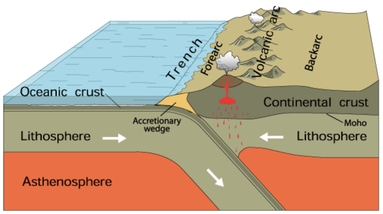
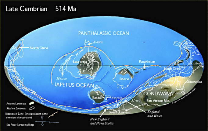
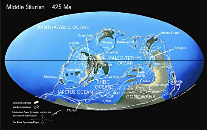
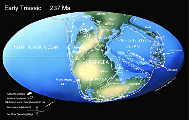
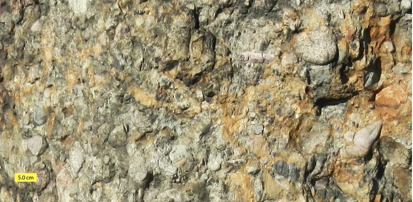
 Subduction. Courtesy of USGS. Subduction. Courtesy of USGS. Imagine a world where South America is at the South Pole, Siberia, along the Tropic of Capricorn, and Greenland, at the Equator. In this world, Florida is a frigid strip of coast connecting South America and Africa. Canada bakes beneath a bright equatorial sun. The rest of North America is a scuba-diver's paradise – assuming scuba-divers numbered among the primitive, single-cell organisms that existed 550 million years ago. Welcome to the Late Precambrian, an era of dramatic geological change and the beginning of New England’s story. At this point, the earth was 3.5 billion years old. It had already experienced multiple episodes of continental drift, volcanism, and glaciation. The Grenville Mountain chain, formed during an earlier period of tectonic collision, had eroded. All that remained was a small layer of bedrock and a large amount of sediment that would eventually become western Massachusetts. Three major continents contained most of the planet’s land mass: Laurentia, Baltica, and the supercontinent Gondwana, whose coastline roiled with volcanic activity. The earthquakes and lava flows were symptoms of tectonic subduction (when one tectonic plate dives beneath another) and rifting (when two plates diverge). Over time, these subterranean stirrings formed the Avalon mountain range and Boston Rift Basin off the coast of present-day South America. We now call this region New England. As Earth entered the Cambrian Period, Avalon broke away from Gondwana. Sediments filled the rift basin and compressed into the Cambridge Argillite and Roxbury Conglomerate (puddingstone) rock formations underlying Greater Boston today. Between 430 and 390 million years ago, Avalon collided with Laurentia, forming the Northern Appalachians. This period of tectonic uplift coincided with rising oxygen levels and an explosion of multicellular life. Complex organisms spread across the globe as New England rose from the depths of the ocean. Over the succeeding eons, the planet’s crust continued to transform. The continents collided again 250 million years ago to form Pangaea, lifting the Appalachians to Himalayan heights, and then separated fifty million years later. This period of rifting created today’s continents and instigated more lava flows. We can still see evidence of this geological turbulence in the igneous and metamorphic rocks of Worcester County. Volcanic activity subsided as the continents drifted to their present locations. Massachusetts was thereafter shaped by deposition, weathering, and erosion. Temperatures rose, fell, and rose again, causing frequent glaciations that carved the Northeastern bedrock. Meanwhile, life evolved. The region was alternately submerged in shallow seas teeming with crustaceans and fish, and raised high and dry, a coastal forest where dinosaurs roamed. By the time Homo sapiens arrived in New England twelve thousand years ago, the region was a frozen tundra. The latest Ice Age scarred the landscape with eskers, dimpled it with kettle ponds, and pimpled it with erratics – a rugged topography that determined where humans settled, and upon which they would eventually unleash their transformative might.
Comments are closed.
|
AuthorArchitectural Heritage Foundation (AHF) is working to preserve and redevelop the Worcester Memorial Auditorium as a cutting-edge center for digital innovation. Archives
May 2022
Categories
All
|
 RSS Feed