|
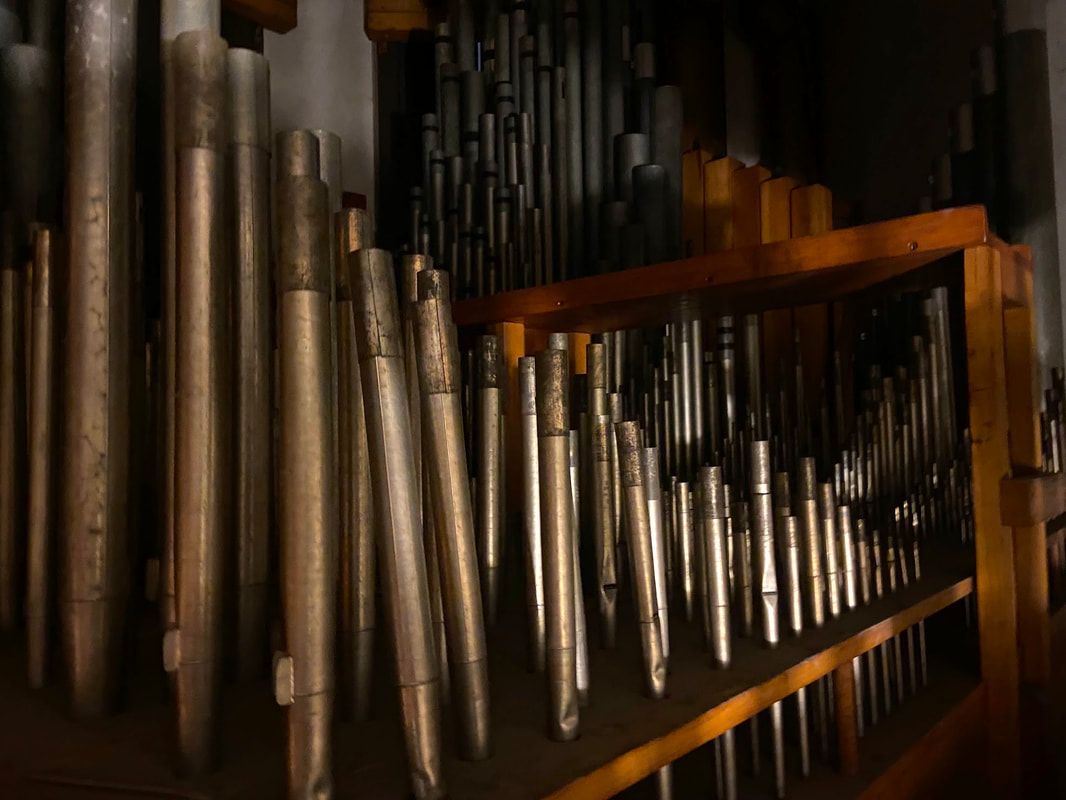
The Worcester Memorial Auditorium is a piece of living history, and touring the space with new visitors will never get old. They are often awed by the enormity of the auditorium and the grandeur and solemnity of the WWI memorial hall. One of our favorite kinds of tours, though, are the ones that include a close look at the Auditorium’s Kimball organ. Most people can appreciate the sheer size and scale of the instrument, but it’s the musicians that stop and gape. This fall, John Roper of Plenum Organ Company, stopped by to conduct an on-site inspection of the instrument, and shared so much information with us. The following are excerpts from his report. “The Kimball organ, housed within the Worcester Memorial Auditorium, was constructed in 1933 and is designated as that builder’s opus number 7199. Comprising 107 ranks, or sets of pipes, the organ boasts a total of 6,841 pipes. These pipes, varying in length from 32 feet to 6 inches, are meticulously crafted from a blend of metal and wood materials. Pipe organs are some of the most complex creations ever made, combining mechanical and electrical parts, all handcrafted from wood, metal, leather, and other materials. Their precise construction ensures their durability. However, like any item made from natural materials, organs need regular care to keep working. While it did receive some attention in 2016, the organ in the Memorial Auditorium has been left idle for some time. As a result of this dormancy, it now needs some work to make it fully playable again. This instrument is a historically significant piece due to its builder, Kimball, a renowned name in the world of organ design and construction. Kimball was known for its tonal design philosophy and was instrumental in the "Symphonic" style of organ building, which sought to make the most lush and warm-sounding orchestral-style instruments. This particular organ, built in 1933, stands as a testament to the high-quality craftsmanship of the firm and the sound of its instruments. Moreover, the organ's unaltered state enhances its historical value, offering a unique glimpse into the original craftsmanship and design philosophy of the era. It is a rare sight to see a Kimball (Chicago) organ in New England which was dominated by the Boston-based builders of the day. The preservation of such an instrument provides invaluable insights into the evolution of organ design and the musical history of the early 20th century. Therefore, it is not just an instrument, but a piece of history that deserves to be valued and preserved. A fitting piece for the auditorium. It's important to note that the organ remains in remarkable condition compared to many of its contemporaries, some of which have been modified or even destroyed. The majority of the issues listed (such as leather deterioration and outdated wiring) are expected given the instrument's age. After all, even we as humans experience wear and tear over time. I strongly recommend leaving the instrument enclosed and unmodified in its current location to ensure its preservation for future generations.” We are so thankful for John’s visit and his report, and we leave you with this moment of stunning beauty, as John plays the Worcester Memorial Auditorium’s 1933 Kimball Organ. The Artist's Family: A Conversation with Marie and Jim Rose, Daughter and Grandson of Leon Kroll4/26/2021
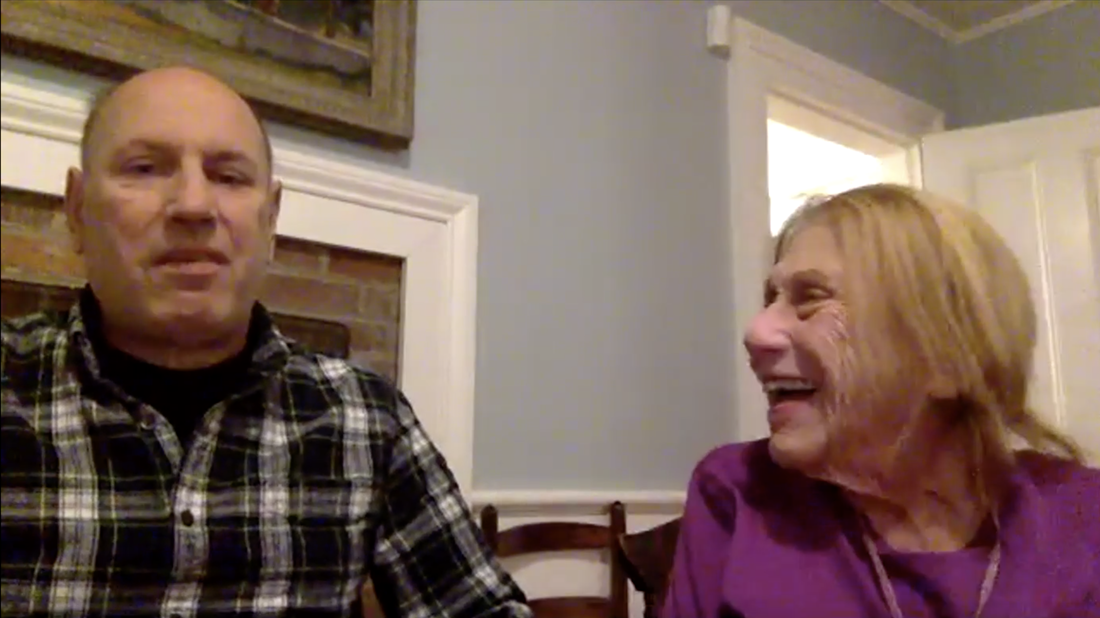
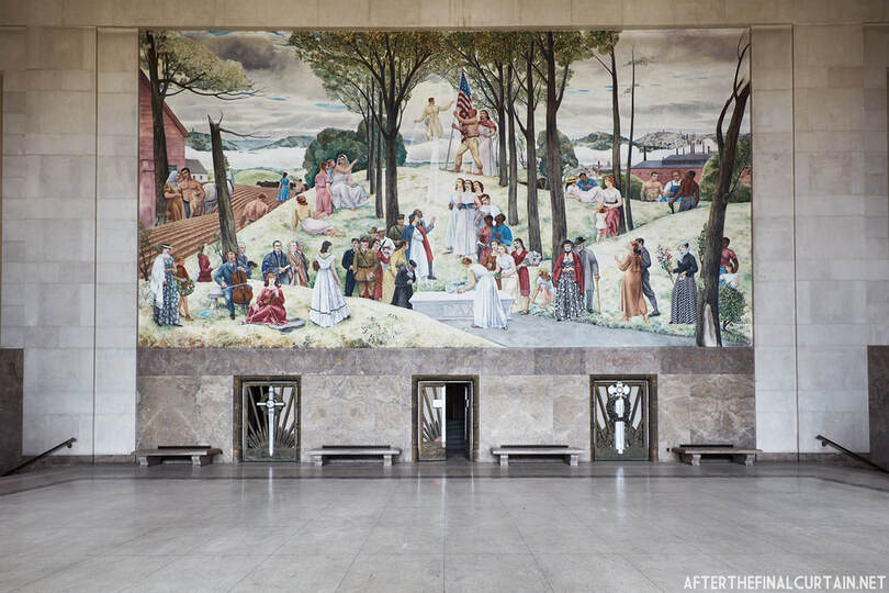
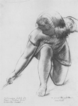
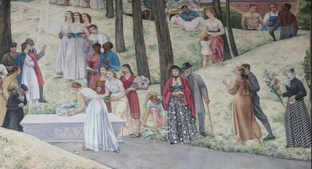
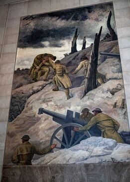
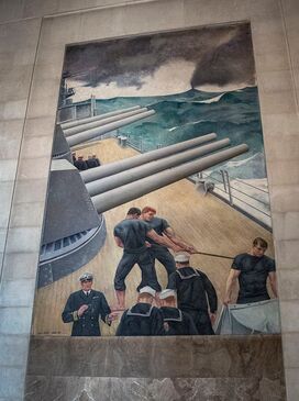
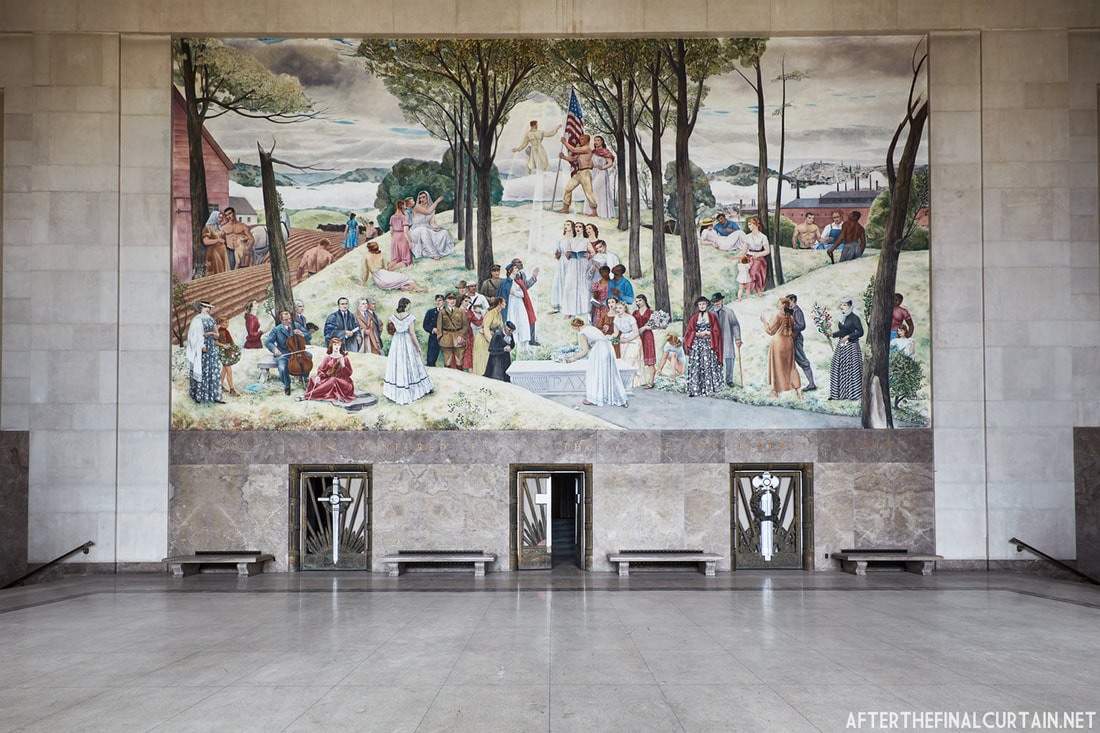
To enter the Shrine of the Immortal at the Worcester Memorial Auditorium is to step into a breathtaking display of devotion. Devotion to the young men and women who sacrificed their lives in a war far from home; devotion to the public and its need to grieve their loss; and above all, devotion to art and its power to heal. The marbled memorial hall echoes with the memories of Worcester’s sons and daughters, whose names are etched in gold on the walls beneath three towering murals painted by renowned artist Leon Kroll. Completed two decades after “the war to end all wars” at the outbreak of a still more terrible conflict, the murals depict in vivid colors scenes of combat and peace, and the everyday heroism of Worcester’s citizenry. In November 2020, AHF staff sat down over Zoom with Kroll’s daughter and grandson, Marie and Jim Rose, to learn more about the artist’s life and work. At 91 years young and with a keen sense of humor, Mrs. Rose is a treasure trove of memories: of a childhood spent in artists colonies during the Great Depression, of her mother Genevieve’s strong influence on her father’s career, of WWII’s impact on her family, and, crucially, of her experience living in Worcester while her father painted the Aud’s murals. Where Mrs. Rose’s recollection faltered, her son Jim affably filled in the gaps and provided some of his own perspectives. The following is an edited and abridged version of the interview. 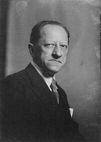 Leon Kroll. Portrait by Arnold Genthe. Leon Kroll. Portrait by Arnold Genthe. Mrs. Rose, where and when was your father born, and what led him to become an artist? MR: He was born in New York. I knew my grandmother, but my grandfather died before I was on the scene. My grandmother was a lovely lady, she was always doing either knitting, crocheting, or doing embroidery. So that might have influenced my father. Your father was the child of immigrants? JR: Yes, from Poland – MR: Well, now it’s Poland. But then I believe that it was Prussia. Because the name Kroll means “king” in Polish, but they spoke German. What was the path that he took to developing into a young artist? MR: Apparently, he was constantly drawing and seemed to enjoy doing it. Luckily, when he was in high school, he had to take German. Of course, they spoke German at home, so he really didn’t need it, but the German teacher and he did not get along, and he punched the German teacher! They were ready to throw him out of the school. But the principal liked him and said, “Okay, you don’t have to take German anymore, but that will be a free period in which you will have to draw and paint.” So that was great for him! He was happy! JR: He loved drawing, and eventually that drew the attention of C.Y. Turner – he was the president of the Art Students League of New York. Turner was a very well-known murals painter, which undoubtedly inspired my grandfather early in his career. My thought is that [my grandfather] used some good, old-fashioned salesmanship to land an internship with Turner. From meeting Turner, he began his artistic education at age 16 when he enrolled at the course of John Henry Twachtman at the Art Students League of New York. Two years later, at age 18, he entered the National Academy of Design. What influenced your father’s artistic style during those years? MR: It was strongly influenced by the French Impressionists, because he also managed to get himself a scholarship to L’Academie Julian in Paris. I think he spent about two years there [before WWI]. He was absolutely taken by [Paul Cezanne’s] paintings. And he was also strongly influenced by Pierro della Francesca. 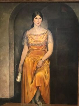 "Portrait of Mrs. Kroll in Yellow." Leon Kroll, 1933. From the collections of the Peabody-Essex Museum. "Portrait of Mrs. Kroll in Yellow." Leon Kroll, 1933. From the collections of the Peabody-Essex Museum. Eventually, he returned to the United States and worked as an artist, but then he made it back to France, where he met your mother, [Genevieve Domec]? MR: That was in 1923. He was in a marrying mood, and most of the girls he went around with thought he was too old. They suggested that he go to France, because French women tended to marry older men, probably because they were more secure, I don’t know. He [had] a friend, an artist called Robert Delaunay, [who] was a Cubist, and his wife Sonia Delaunay, [who] designed the sets for the Ballet Russe de Monte-Carlo. Dad said, “Do you know a nice French girl?” And they said “Yes, but she’s very proper.” So Sonia called up my mother, she showed up... Then mother told him, “I’m going to Malmaisson-en-Seine” – where my grandparents had a summer place – “and anybody who wants to come, come.” The only person who showed up was my father! Apparently, he impressed my uncle Pierre by being a very powerful swimmer, because my grandparents’ property was just about a field away from the River Seine, and he knew how to swim against the current. Within six weeks of knowing [my mother,] he proposed. And she married him! And eventually your father persuaded your mother to immigrate to the United States? MR: Yes. First they lived in Chicago, because Dad got a job at the art institute. And Mother said about Chicago, she just couldn’t take the cold winters, but she met the loveliest bunch of people there. There was a story, too, about the window washer – he was sort of a tip-off man for [mobster Charles] O’Banion in Chicago – who said, “You shouldn’t steal anything [from the Krolls’ home], there’s nothing but paintings!” My mother said, “We felt terribly snubbed!” How did your mother support her husband’s work? MR: She was a fabulous cook. They did a lot of adult entertaining. JR: She had good salesmanship – sales and marketing skills. MR: Oh, yes – they were constantly entertaining. So that certainly helped my father’s business. 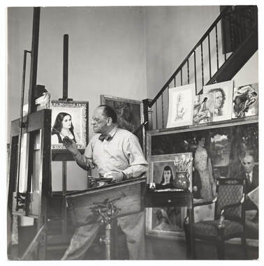 Leon Kroll in His Studio, 1931. Photo by Jane Rogers. From collections of the Archives of American Art. Leon Kroll in His Studio, 1931. Photo by Jane Rogers. From collections of the Archives of American Art. What was your father and your grandfather like in person? MR: As an artist, I would describe him as very disciplined. In the morning, he would go out and do scenery, but in the afternoon, he always had a model that he drew. Every day he drew. He took his work seriously. And as a person, I would say – he was liberal in his politics, but never a Communist. He had one experience with a Soviet-American friendship, and he left it very quickly after, he realized they were a Communist front organization, and he wanted nothing to do with them. He was more into what was going on with the National Academy of Design, the American Institute of Arts and Letters, and the American Academy of Arts and Letters. He was more into that than he was into politics or anything like that. Also I would say that as far as his Jewishness was concerned, he was not a practicing Jew. However, the one interesting thing about my father was, we were required to wash our hands before we had a meal. And also, yes, he liked his scotch-on-the-rocks before dinner, but he didn’t drink very much, and he liked good food, but he wasn’t a particularly picky eater. Of course, my mother was a superb cook. Unfortunately, she just didn’t have the patience to teach me anything. If I was doing something wrong, she would grab it from me. I guess she just didn’t want to see her beautiful work ruined. 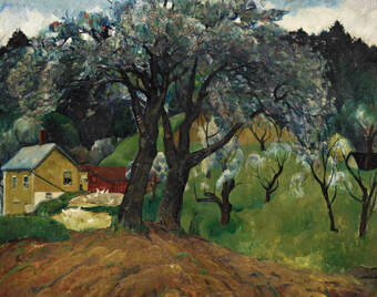 "Appletrees, Woodstock." Leon Kroll, 1922. From Sotheby's website. "Appletrees, Woodstock." Leon Kroll, 1922. From Sotheby's website. You were born just in time for the Great Depression to hit. What do you remember from that period, and how did your father manage to keep making art? MR: I think they did have problems during the Depression, like most people did. Mother was wondering how she could support me, and she wrote to my grandmother about that, but – [shudders] I didn’t particularly like a summer I spent in France when I was six with my grandmother. My grandmother felt that I was badly behaved, so she decided that she had to apply la discipline! She was very, very strict. I can remember if I didn’t like some food, oh God, there was no end of scolding. I mean, she was just scold, scold, scold. JR: My mother never lived outside the States. [But] she moved around a lot. MR: Oh, yes. We lived in New York in the winter until I was nine. Then my father, fortunately, got to paint the murals in the Attorney General’s office. And then he entered the competition for the paintings in the Worcester Memorial Auditorium… Dad had to do the sketches for the Worcester murals, so we rented his sister Jane’s house in Bearsville, NY. I spent a rather nice year there, where I went to a one-room schoolhouse! We skated, and we skied, and there was a lot of winter sport, and also a lot of nature study – the teacher was very strong on that. And for a one-room schoolhouse, I actually learned a fair amount. Before that I’d gone to the Lennox School in New York, and I always felt I was the poor relation there. What it was like to learn in a one-room schoolhouse? MR: It was a combination of the natives, and then the artists who would want to hang around Woodstock and Bearsville and would dump their kids in the one-room schoolhouse from September to November. Then they would go back to New York…and then, come spring, [the parents] decided, “Oh, we want to go back to Bearsville, the Catskills,” and then some of the kids would be dumped into the one-room schoolhouse with all the natives. I can remember we had certain textbooks that we read and talked about, and also we had to read to the younger children. So the school, although it certainly didn’t have the philosophy of progressive education, I guess you could say in practice it was progressive education. Do you remember the details of the competition to paint the Worcester Memorial Auditorium murals, and who else entered? JR: We do know who some of the judges were. The Worcester World War Memorial Commission included Ralph Earle, George Barton, Edward Hayes, Charles Allen, George Booth – he was the Chairman – Michael O’Hara, George Fuller, John White, and Harrison Taylor. They were all businesspeople or lawyers, highly regarded citizens of Worcester. What years did you live in Worcester? MR: We came there in the fall of 1939, and we left in the spring of 1941. I can remember Dad having the radio on and hearing about Hitler’s invasion of Poland. Mother wanted to go back to France to visit her family. My father said, “No. Too dangerous. But I will sponsor one of your family to come to the United States.” So Mother’s younger brother, Claude – he was an artist, and he designed tapestries for Aubusson – he came over. He lived with us when we were in Bearsville and also when we were in Worcester. Uncle Claude was a nice guy, but what I remember about him, and that really got me angry with him, [was that] he never felt the need to learn English… I think he understood more than he spoke. Because he did have a job at the Metropolitan Museum and did all the swear words, but not much else. But he didn’t like it when he heard it from me! 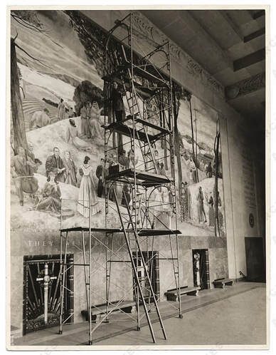 Leon Kroll painting a mural in the Worcester Memorial Auditorium, 1935. Source: https://elhurgador.blogspot.com/2013/10/manos-la-obra-xxvi.html. Leon Kroll painting a mural in the Worcester Memorial Auditorium, 1935. Source: https://elhurgador.blogspot.com/2013/10/manos-la-obra-xxvi.html. Do you remember any discussion between your father and your mother regarding the decision to move to Worcester? JR: My grandmother was not particularly excited about going to Worcester. MR: No, she wasn’t. And she was very unhappy there. I think that [my parents] managed to get into the wrong crowd of people. They were just a whole bunch of very snooty WASPS that looked down on her. Mother said that when France got defeated, the snobs in Worcester wouldn’t speak to her. And I guess [my parents] just didn’t realize the fact that Worcester was a [city] that had colleges…and also that there were professional people in Worcester that might have been more accepting of her than these so-called snooty WASPS. But she did make good friends with the writer Esther Forbes, and also this crazy lady, Mrs. Snow. Mother [told] a story about Mrs. Snow, that she had the artist Paul Sample over to lunch…and she was looking at Paul Sample and saying, “Oh, those big blue eyes!” So she was always propositioning people! I can remember going to Christmas parties at Mrs. Snow’s, she’d have a nice punch and what have you, and it was a lovely party. And when I went to Bancroft, she talked to us about her trips in Europe. But Mother liked her, because the way she handled Worcester was, she just did her own thing and couldn’t have cared less what the other people thought. How did you handle Worcester? MR: Well – I did and I didn’t. The first year I spent at the Bancroft School, which was a private school, and while I learned a lot there, the children were just so mean to me! They criticized my clothes constantly, because I remember having bought clothes that were appropriate for Bearsville, NY, but not for Worcester [or] for the Bancroft School. So I was constantly being ridiculed about my clothes, and I felt that was pretty nasty. I just didn’t want to go to that school again, so I ended up at Sever Prep. Now, Sever Prep, the kids were great, everybody was nice. But I don’t think I learned as much as I did at the Bancroft School. What was the process of creating and then executing the murals? MR: He did the sketches in Bearsville, and then when he was working on the mural, he enlarged it. However, during the course of that, he fell off the scaffold and broke his leg! He went to Memorial Hospital in Worcester, and he happened to have an excellent surgeon called Dr. Johnson. He was just out of commission for about six weeks. He did some drawings and stuff in the house where we were living, and he had somebody helping him out who was also one of his models, Gloria Rathay. She was the blonde gal with the braids [in the Aud’s center mural]. And she also did secretarial work for him, so he was productive while he was laid up at the house. Was your father the only person who painted the murals? MR: No, he had two assistants, Claude and an artist called Nick Corone, helping him out. Claude did the leaves, and then Nick would do something else. Things like the trees and the leaves, the assistants did. I think [my father] did more of the people. Do you recognize any of the people depicted in the murals? MR: This lady in the foreground [of the center mural] with the black hat and the black print dress seems to look like my mother. Also, the person who is putting the wreath on the coffin of the soldier looks like Gloria Rathay, because I remember she was a blonde with braids. I can’t tell you what some of the other people were. For the sketches, some were from Bearsville, but then when he went to Worcester, he also needed live models, so he used some people from Worcester for that. How often did your mother pose for your father? MR: On-ishly and off-ishly. She didn’t like posing, because you had to sit still and not say anything. I’ve posed for him. And it isn’t the greatest of things to have to do. You had to have infinite patience and be willing to keep your mouth shut, because Daddy was concentrating. What do you remember of Gloria Rathay? MR: She lived on South Flagg Street in Worcester, and her father was a contractor, and he had built all the houses on Flagg Street. I don’t know how Dad came in contact with her, but I guess he saw her somewhere and that she had the right hair or something like that. And that while she was posing for him, she also did secretarial work for him. Do you remember any men posing for him as World War I soldiers in the Army and Navy murals? MR: No, not really. I don’t know whether the guy with the sweatshirt was Nick Corone, one of his assistants. I do know more about the naval story… My father had painted the floor of the battleship grey. And somebody told him, “No. The floor of the battleships were painted yellow.” So he had to change the color. Do you know what happened to any of the models for these murals after World War II broke out? MR: I really don’t know. Because we moved away and lost touch. Did you or your father ever visit the Auditorium after he completed the murals? MR: Once, several years after. I thought [the murals] were lovely! And certainly well-crafted and certainly well-worth saving. JR: We’re hoping you guys can put together some financing, even in this COVID situation, and hopefully restore that building to the way it was seventy years ago. Jim, have you visited the Aud? JR: Yes, Preservation Worcester hosted a fundraiser at the Auditorium back in 2013, and Julie and I went to that. So that was pretty exciting. Why is the Aud important to you? JR: It was a game-breaker for my grandfather, it really helped put him on the map. MR: Of course, he had been put on the map with the Attorney General’s office murals before that, but he got the Indiana commission and also the Johns Hopkins commission certainly as a result of [the Worcester murals]. What do you hope will happen with the Worcester Memorial Auditorium? JR: Well, we want you to close the financing, we want you to get this deal done. MR: Yes, because I think it’s certainly a beautiful mural, and it should be preserved. The Worcester Memorial Auditorium is a redevelopment project by the Architectural Heritage Foundation (AHF), a 501(c)3 dedicated to stimulating economic development in under-resourced communities through historic preservation. Follow the Aud project on Facebook, Twitter, and Instagram.
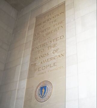 “The preservation of the sacred fire of liberty…entrusted to the hands of the people." - George Washington “The preservation of the sacred fire of liberty…entrusted to the hands of the people." - George Washington Oscar Larsson was twenty-one when he modelled for Leon Kroll. Blonde and barrel-chested, the former high school football star posed shirtless, grasping a long pole as the artist sketched. Within a few months, Kroll had immortalized Oscar in a sprawling mural at the Worcester Memorial Auditorium. The young Worcester native is depicted receiving an American flag from a WWI soldier ascending to heaven. “The irony of all this is, [the mural] was finished in May 1941, and in December 1941 we went to war,” 98-year-old Oscar told the Worcester Telegram and Gazette in 2018. “So the flag was passed to the next generation, and I was part of it. I went into the service myself after that.” Service, sacrifice, and hope for a better world – these are the cornerstones of a building conceived and constructed during crisis. Nowhere in the Aud are these values more apparent than in the Shrine of the Immortal, the memorial hall where Oscar stands frozen in time above the names of Worcester’s WWI fallen, surrounded by painted figures whose lives also would soon be upended – and perhaps ended – by the Second World War. Created at the height of the Great Depression, in the interlude between two global conflicts, and in the wake of the Spanish influenza, the Shrine of the Immortal is at once a testament to past challenges and an aspiration for a more harmonious future. The stories it contains speak to our own tumultuous era. 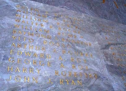 The names of Worcester's fallen WWI soldiers and nurses inscribed in the Shrine of the Immortal. Photo courtesy of MassLive. The names of Worcester's fallen WWI soldiers and nurses inscribed in the Shrine of the Immortal. Photo courtesy of MassLive. The fact that the Aud was built at all is remarkable considering the dire state of Worcester’s economy in 1931-1933. The industrial city was among the hardest hit in Massachusetts by the stock market crash. Factories halted production and unemployed mill workers formed breadlines that snaked through the streets. Yet Worcester leaders pressed ahead with the Aud’s construction. They put people to work on a $2 million civic infrastructure project that anticipated the Works Progress Administration endeavors. In 1933, the completed building was dedicated before a crowd of spectators as “an enduring tribute to those whose sacrifice was sublime, a majestic memorial for the use and benefit of many generations." And use it people did. During the week following the dedication, Worcester residents enjoyed concerts and other events in the auditorium that provided brief, but much-needed respite from the anxieties of the Depression. At a time of acute financial hardship, the City leadership provided jobs to many and a space for cultural expression to all. The Aud was also intended as a space for healing in the wake of a global conflict and pandemic. Inscribed on the Shrine of the Immortal’s marble walls are the names of 355 young men and women whose lives were cut short during WWI. Many were buried far from home or lost at sea. In lieu of a grave, their bereft loved ones came to the Aud, searched for their names, and sat in reflection upon the stone benches beneath Leon Kroll’s towering murals. Morris Bailey’s family would have remembered a teenage boy who left high school and a comfortable homelife to enlist with an aero squadron; who survived two years of war, making a surprise visit home for Christmas in 1918; who was recalled into service the following year in anticipation of post-armistice violence and died in a training plane crash at age nineteen. Aurelia and Horace Wyman’s sister, Louisa, would have recalled her two siblings – a war nurse and a lieutenant, respectively – who both died of influenza in Europe, where she, herself, was also serving as a nurse. And as a new generation of youth marched off to the battlefields of WWII, those they left behind might have found solace beneath the words of George Washington, carved beside Leon Kroll’s newly completed mural: “The preservation of the sacred fire of liberty…entrusted to the hands of the people." 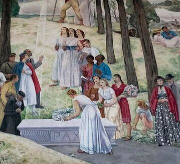 Detail from Leon Kroll's mural in the Shrine of the Immortal. Original photograph courtesy of MassLive. Detail from Leon Kroll's mural in the Shrine of the Immortal. Original photograph courtesy of MassLive. Though rooted in remembrance, the Shrine of the Immortal also aspired to a more peaceful and equitable future. At a time when Jim Crow and redlining widened racial divisions, the Great Depression ravaged the lives of low-income people, and New Deal-era muralists painted sanitized images of oppression, Leon Kroll depicted a world in which "people of all classes and races gathered in peace and harmony under the American flag." The people shown are laborers, soldiers, nurses, musicians, mothers. They are Black and white, young and old. Side by side, they devote their energy to building a more prosperous Worcester and their prayers to building a more peaceful world. Behind its imposing granite columns, the Aud offers guidance for our own troubled generation. It is a tangible lesson on the importance of a communal response to crisis. The building exists thanks to those who labored through financial hardship to create a public gathering space for the benefit of people they did not know. Its stones bear the stories of those who willingly risked their lives in battle and on hospital wards. Its murals envision a more just society. Ultimately, the Aud reminds us that there is work to be done in service of something larger than ourselves, and that the surest way to accomplish it – especially during turbulent times – is by coming together.
For this installment of "This Old Neighborhood," AHF decided to try something different: creating a map of Worcester shortly after this third and final establishment. We drew from a variety of eighteenth and nineteenth-century sources to reconstruct the town as it appeared in 1720. The map includes major roads, defensive garrisons, houses of worship, a burying ground, saw/grist mills, a tavern, and nineteen of the fifty-eight residences reported to have been built by that early point in the town's history. All locations are approximate.
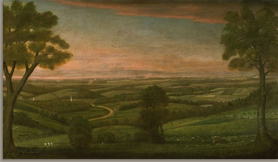
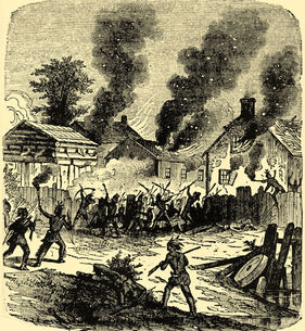
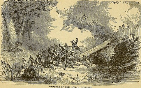
In 1720, Worcester's population is estimated to have numbered two hundred. The town was largely pastoral, yet already saw mills and grist mills - the beginnings of industry - were appearing along the many streams that coursed through the hilly terrain. A web of footpaths criss-crossed the meadows and forests, skirting beaver ponds, many following Nipmuc routes. Some had been widened into roads, which remain important thoroughfares in Worcester today: Main Street, Plantation Street, Pleasant Street, Burncoat Street... The town quickly expanded, growing more populous and prosperous by the year. How to use the map: Click the rectangular icon in the map's upper left corner to access the key, description, and sources. Clicking on the map's individual icons (e.g. houses, horses, etc.) will cause labels and descriptions of each feature to pop up. To zoom in and out, click the + and - symbols in the bottom left corner. 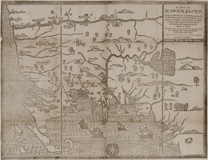 "A Map of New England," originally published in William Hubbard's "Narrative of the Troubles with the Indians," 1677. Massachusetts Historical Society. Oriented with the West at top, the map uses numbers to represent communities attacked by Native fighters - the number 17 (slightly left of center) denotes Quinsigamond Plantation. The city of Worcester got off to a rocky start. Quinsigamond Plantation, as it was called in 1675, was located in New England’s western frontier. Like other nearby colonial outposts, it had sprung up along the Boston Post Road to satisfy land-hungry colonists and expand Massachusetts territory, often at the expense of indigenous populations. The village had been purchased for a pittance from the local Nipmuc in 1674. Lots ranging in size from 25 to 100 acres had been laid out on “Indian broken up lands,” the settlers’ term for former Native agricultural areas. A two-story, wooden garrison house – the “old Indian Fort” – guarded the plantation and the approximately thirty Englishmen who called it home. Relations between the Quinsigamond Plantation settlers and the Nipmuc were initially calm, though colonial authorities tried to exert political influence over their Native neighbors. In September 1674, the Reverend John Eliot and Daniel Gookin visited the nearby village Pakachoag, where they were “kindly entertained” by sagamores Horowanninit (known to the English as Sagamore John) and Woosanakochu. Eliot and a Christianized Nipmuc minister, James Speen, preached and led a prayer service. A resident council then approved the two sagamores “to be rulers of this people and co-ordinate in power, clothed with the authority of the English government” and accepted Speen as their minister. It is unclear whether the villagers did so because they sought the colonial government’s protection or simply to humor their visitors. Whatever the case, the outbreak of King Philip’s War disrupted all efforts to forge tighter bonds between European authorities, Quinsigamond Plantation, and the Nipmuc. 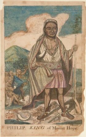 Paul Revere's imaginative depiction of Metacomet, 1772. Mabel Brady Garvan Collection, Yale University Art Gallery. Paul Revere's imaginative depiction of Metacomet, 1772. Mabel Brady Garvan Collection, Yale University Art Gallery. Largely forgotten in public memory today, King Philip’s War was the bloodiest conflict in American history. What began as a Native rebellion against English colonization morphed into a war of extermination whereby the Wampanoag, Massachusett, Nipmuc, and Naragansett joined forces to oust the colonists from the region, and the English, with the help of Mahican, Pequot, and Praying Indian allies, fought back with equal or greater brutality. Between the war’s outbreak in June 1675 and its end in August 1676, up to forty percent of New England’s indigenous population had been killed, died in captivity, or sold into slavery. Five percent of colonists had perished and 67 English towns were destroyed, mostly on the frontier. Quinsigamond Plantation was among them. Hostilities erupted in the vicinity of Quinsigamond in June 1675, when the rebellion’s leader, the Wompanoag grand sachem Metacomet (also known as King Philip), forged an alliance with Horowanninit and the Nipmuc, and destroyed the colonial town of Quaboag (Brookfield). A month later, the constable of Pakachoag, Matoonas, attacked Mendon to avenge the execution of his son by the English in 1671. The region descended into violence. Companies of English soldiers indiscriminately ravaged the villages and crops of both enemy tribes and Praying Indians, and interned captive men, women, and children on the notorious Deer Island and Long Island in Boston Harbor. Meanwhile, Native fighters razed English settlements, among them Grafton and Marlborough. Tiny Quinsigamond Plantation was soon abandoned, and many of its initial settlers, including Ephraim Curtis, joined colonial forces against the rebelling tribes. The empty village was used occasionally as a military outpost until a band of Nipmuc burned it to the ground on December 2, 1675. Upon hearing the news, the fiery Puritan minister Increase Mather interpreted it as a sign of divine wrath. The violence raged through the winter and spring, when it became clear that the English were prevailing. Surviving Natives who were not enslaved or imprisoned gradually retreated from their ancestral homelands. Sensing defeat, Horowanninit of Pakachoag village and 180 followers abandoned their allegiance with Metacomet in July 1676 and entreated the colonial government in Boston for peace. As a sign of goodwill, they captured Matoonas, executed him on Boston Common, and impaled his head nearby, as his son’s had been five years earlier. Their gesture did little to gain the colonists’ trust: of the original 180 men, eleven were executed, thirty sold into slavery, and the rest imprisoned on Deer Island (which they soon escaped). When the war ended in August with Metacomet’s death, Horowanninit and his remaining followers returned to Pakachoag to find the region depopulated. Fewer than one thousand Nipmuc now inhabited what had once been a center of tribal life.
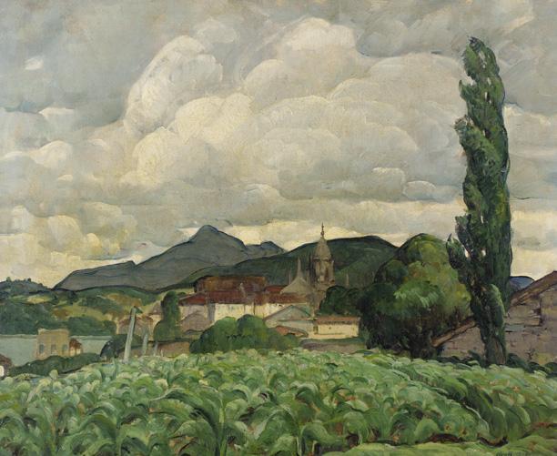
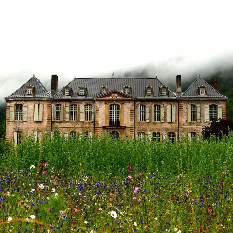
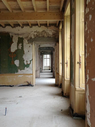
English settlers, too, returned to the area. Quinsigamond Plantation was rebuilt between 1678 and 1686 and renamed Worcester. Houses, mills, a church, a school, and a fort sprang up to replace the ones that had burned during the war, and colonial authorities allotted land to the settlers who moved in. However, the town’s renaissance was short-lived. Native unrest resurfaced in the 1690s, and the beginning of Queen Anne’s war in 1702 sounded the death-knell for the reestablished village. Horowanninit led his fellow Nipmuc in raids against Worcester, causing its residents to flee a second time. In 1713, the English made a third attempt to settle the area. This time, they succeeded. The town of Worcester grew into a thriving city whose diversity belied its bloody beginnings. And although colonial warfare devasted the Nipmuc, they were not exterminated. To this day, members of the Nipmuc Nation call Worcester and the surrounding region home. The Worcester Memorial Auditorium is often seen as a white elephant, but across the Atlantic, another adaptive reuse project is demonstrating the rewards of rehabilitating a monumental historic treasure. Château de Gudanes is an eighteenth-century palatial mansion nestled in the Pyrenees, and it has seen better days. Built around 1745 on the site of a 13th-century castle, it was the luxurious residence of several generations of French nobles and members of the bourgeoisie. Confiscated during the French Revolution, pillaged four decades later by "Demoiselles" (local residents protesting aristocratic forestry laws), and used as a children's summer camp after WWII, the Château bears witness to 260 years of French history. In the 1990s, plans to redevelop the building as a luxury hotel fell through when the government designated the site as a Class 1 Historic Monument subject to strict restoration regulations. Exposed to the elements and without a caretaker, Château de Gudanes deteriorated. Fortunately, what appeared to be a preservation failure story may be on its way to a fairy-tale ending. The Château spent four years on the real estate market before a young Australian discovered it online in 2011. His parents. Karina and Craig Waters, were intrigued and traveled to France to view the property. Access to the building's interior was forbidden: part of the roof had collapsed, and the consequent water damage and mold had destroyed most of the 93 rooms. Nevertheless, the Waterses immediately fell in love with the crumbling neoclassical palace and its overgrown grounds, framed against steep limestone cliffs. They purchased the property and began renovations in 2013. Since then, the Château has made a slow, but steady recovery. The Waterses have overcome red tape, hired caretakers, and enlisted an army of professionals, locals, and the just plain curious to rehabilitate the building. They intend to accomplish the work as efficiently and sustainably as possible by recycling original features and using locally sourced materials, such as downed wood from the Château parc. Already they have restored floors and walls that had caved in, repainted frescoes, installed hand-made furnishings in stabilized rooms, and seeded the grounds with wildflowers. Nine bedrooms and two kitchens have been rehabilitated and some underfloor heating installed. Locals have shared their knowledge and skills with the restoration team, including a lady who spent a day in the kitchen preparing dishes her grandmother used to make as Château chef. In fact, the Waterses have opened the property during summer to visitors, who are welcome to stay for up to a week as long as they register for a workshop (topics include patisserie baking and fresco restoration) help with the rehabilitation or cooking, and are willing to navigate the building at night by candlelight (all proceeds facilitate the preservation efforts). The couple summed up their vision for the Château on their website: Our aim is to tread lightly and gently - to preserve the atmosphere and authenticity of the Chateau and region as much as possible. She will be renovated but her rawness, wear and history will not be erased, but instead integrated...The Chateau won’t be a pretentious museum piece, but rather, a place to visit, reconnect with the earth and people, and restore the senses, just like she herself has been restored. It won’t be about overcrowding the walls with paintings or overflowing the floors with furnishings, but will be relatively minimalistic - a place to simply rest, breathe and enjoy the calm. Château de Gudanes has a long way to go before it is fully restored, but in the meantime, it remains an inspiration to preservationists like AHF who are pursuing seemingly impossible projects. Though the Aud is worlds away from this palace in the Pyrenees, it shares certain characteristics: a rich history, astounding architecture, and a passionate local community. If the Château de Gudanes - a behemoth tucked away in a remote, mountainous enclave - can be rehabilitated, then surely the Aud - prominently located in a busy district of Worcester - can, too!
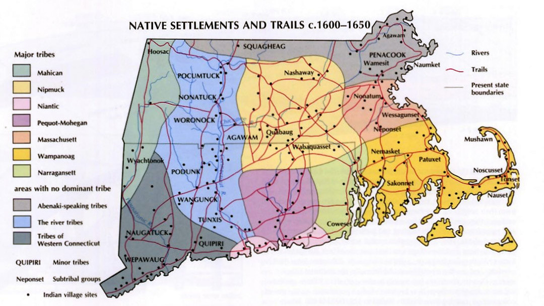
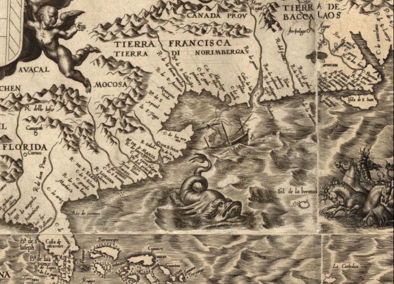
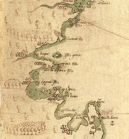
Visit the Château de Gudanes website: https://www.chateaugudanes.com/ In popular memory, the modern history of Massachusetts began in 1620 with a group of English religious zealots. These men, women, and children are said to have ventured into an unknown region of the New World, a wilderness home to Native Americans who previously had never seen a European face. Massachusetts Bay, the story goes, was discovered, explored, and exploited by English dissidents. But popular memory often plays tricks. The Pilgrims encountered a region that was neither unmapped nor unaware of the wider world. Rather, it had played a role in the imperial Atlantic power struggle for decades. The coastal plains and rolling hills that would become so important in United States history were and remain home to many Algonquian-speaking tribes. Massachuseuck territory, named for the sacred Great Blue Hill (Massachusett, “Big Hill Place”), stretched across present-day Greater Boston. To the west lay Nippenet (“Freshwater Pond Place”), land of the Nipmuck. Their neighbors included the Wampanoag along the Cape; the Pocumtuck, Nonatuck, Woronock, and Agawam along the Connecticut River; the Muheconeok in the Berkshires; and the Penacook and Squagheag to the north. Dozens of long-distance trails connected villages throughout New England, facilitating trade, inflaming rivalries, and strengthening allegiances. Not only people and goods, but information traveled along these routes. When oddly clad strangers appeared offshore, the news would have spread like brushfire. 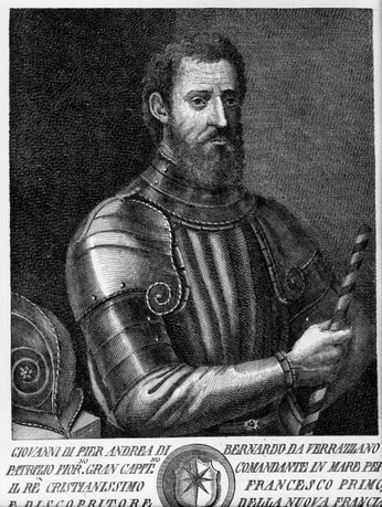 Giovanni da Verrazzano. Piermont Morgan Library. Giovanni da Verrazzano. Piermont Morgan Library. Five hundred years after Vikings first reached Newfoundland, Europeans became a regular presence in northern American waters. Basque, Portuguese, English, and French fishermen plied their trade off the coast of Canada, and there is evidence that they came into contact with Mi’kmak or Abenaki tribes in Maine as early as 1519. By the end of the century, a steady stream of European fisherman hunted whales and cod around Massachusetts Bay. They probably ventured ashore for fresh water and, perhaps, to trade with Native inhabitants. Official European exploration of New England began with an Italian working for France. In 1524, Giovanni da Verrazzano sailed west aboard La Dauphine in search of the fabled Northwest Passage. Upon reaching the lands of Siouan-speaking tribes (North Carolina), he kidnapped a boy to bring back to France and then turned north, hugging the coastline. He ventured into the areas of Mahican and Nahigansett (New York and Rhode Island), sailed past treacherous sandbanks and a “high promontory” that he named Pallavisino (Cape Cod), and proceeded to Wabanakhik (northern Maine), before ending his expedition in Beothuk territory (Newfoundland). Like many Renaissance voyagers, Verrazzano portrayed North America as a resource-rich idyll; present-day Rhode Island was “suitable for every kind of cultivation – grain, wine, or oil,” while Cape Cod “showed signs of minerals.” Notably, he described Natives’ varying attitudes towards the Europeans. Most, including the Narragansett, were “generous” and “gracious;” some were fearful; and the Abenaki were downright hostile: they insisted on trading “where the breakers were most violent,” attacked sailors who came ashore, and mooned Verrazzano’s crew upon its departure. Such behavior suggests that Maine tribes had a painful encounter with European fishermen even before La Dauphine arrived. Their neighbors to the south would soon have similar experiences. Exploration increased in the late sixteenth and early seventeenth centuries, spurred by stories of a northern El Dorado. Maps of the New World increasingly identified present-day Maine and southeastern Canada as the mythical Norumbega, a region of vast wealth that captured Europeans’ imaginations. In a possibly fictive and certainly fanciful travel account published in 1589, the sailor David Ingram claimed to have journeyed overland from Florida to Cape Breton and to have visited Bega, a city replete with “rubies six inches long,” pearls, and gold. The rumors lured Samuel de Champlain across the Atlantic in 1605. Though he discovered neither Norumbega nor the Northwest Passage, he did produce one of the earliest maps of Boston Harbor and an account of the people living there: “We saw in this place a great many little houses, which are situated in the fields where they sow their Indian corn. Furthermore in this bay there is a very broad river which we named the River Du Gas.” To the Massachuseuck, this river was the Quinobequin. To the Puritans, it would become the Charles. Europeans continued to frequent Massachusetts Bay in the years leading up to the founding of Plymouth Colony. Henry Hudson, John Smith, and Thomas Dermer all made the voyage, with disastrous consequences for Native peoples. In 1614, Smith’s associate Thomas Hunt kidnapped twenty-four members of the Patuxet tribe, including the renowned Tisquantum (Squanto), to sell as slaves in England. Hunt’s action upended the delicate trade relationship between the tribes and the English, initiating a period of open hostility. Indeed, local inhabitants might have stymied later colonization attempts if not for an invisible enemy that ravaged New England populations prior to 1620.
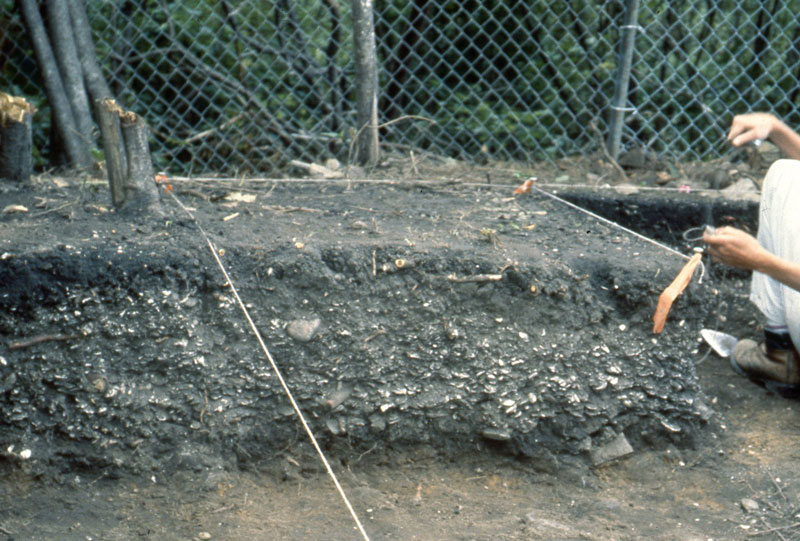
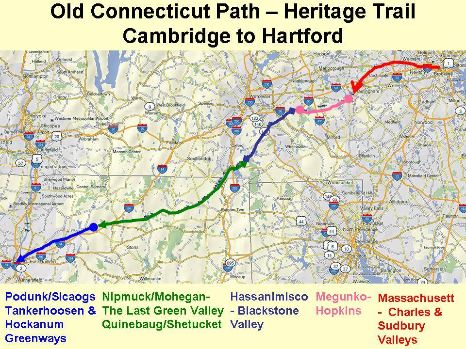
With the boatloads of Old World fishermen and explorers came an influx of Old World pathogens. Intermittent epidemics may have begun as early as the sixteenth century. Scholars debate which diseases swept through New England before the Pilgrims arrived; leptospirosis seems most plausible. One thing is clear, however: between 1616 and 1619, a plague decimated Native tribes. In 1619, Tisquantum returned home to a dead village. Scholars estimate that disease claimed the lives of 75-90% of eastern Massachusetts peoples over the course of the seventeenth century. The survivors were hard-pressed to repulse the thousands of colonists who poured into the region – and with whom the recorded history of Brighton and Worcester begins. When English colonists arrived on the shores of Massachusetts four hundred years ago, they beheld an unfamiliar territory almost devoid of features that might have reminded them of home. There were no carriage paths or cattle pastures, no rooting hogs or crowing roosters, no church steeples or tolling bells. Steep drumlins loomed above the coast, beyond which forests and marshland stretched westward. Mountain lions skulked behind boulders. Wolves howled at night. To settlers accustomed to a treeless countryside subdued beneath the plow, New England was a “vacant wilderness…a place not inhabited but by the barbarous nations.” Little did they understand the way of life that those nations had created over the past three thousand years. Massachusetts during the Woodland Period (3,000-400 BP) was not a pristine wilderness, but an increasingly manipulated landscape home to tens of thousands of Native Americans. As post-glacial sea levels stabilized, Woodland peoples adopted new patterns of habitation and movement that spurred agricultural, technological, and cultural development. Many gravitated toward coastal areas and established long-term seasonal settlements, where they began to plant crops. Initially, they selectively bred weedy vegetation including sunflower, goosefoot, and sumpweed, and boiled the seeds in porridges. By 1000 CE, Central American cultivars – maize, squash, and beans – had arrived in New England and were becoming increasingly important in local diets. Woodland peoples’ migratory lifestyles enabled them to diversify their food sources. Archeological evidence, such as shell middens (ancient trash heaps) on Spectacle Island, suggests that Native Americans settled in large villages during the spring and fall, where they planted and harvested crops, fished, clammed, and hunted, and held political meetings (indeed, in 1614, explorer and colonist John Smith recorded that Native peoples grew maize on the Harbor Islands). During the summer and winter, many villages disbanded. Residents moved to smaller settlements in the region to better exploit food sources while crops ripened or the ground lay frozen. Agriculture transformed the Massachusetts landscape. Though the area remained heavily forested at the time of European contact, patches of cleared ground reflected repeated seasonal use. Native Americans believed that they owned the use of land, rather than the land itself; instead of adopting permanent farming sites, they tilled soil until it was no longer fertile (about eight to ten years) and then relocated. Women cleared new land by setting fires at the base of trees to kill them, and, once the dead wood fell, by burning it away. This method, along with the practice of burning fires all night during both the winter and summer, meant that localized deforestation was common. Thousands of acres near Boston were treeless by 1630; elsewhere, the whitened trunks of girdled trees surveyed cornstalks intertwined with bean and squash vines. Far from a “vacant wilderness,” Massachusetts was an intensively used homeland. Fire enabled local tribes not only to grow crops and stay warm, but also to hunt, gather, and travel. English colonists were astounded that Woodland peoples set large ground fires in the forests during the spring and fall, and were equally impressed with the effects. The woods near Native villages tended to be clear of tangled undergrowth. The widely spaced trees, grass, and pioneering berry bushes created a park-like setting that attracted game, facilitated hunting, and limited the risk of future fires burning out of control. The relative openness of Woodland Period forests also eased long-distance travel. Overland routes developed over thousands of years, crisscrossing tribal territories. Among the most famous was the Old Connecticut Path: it began near present-day Cambridge, following the Quinobequin ("meandering," later Charles) River through Massachusett territory before curving southwest into Nipmuck land. From there, it passed south of present-day Worcester and continued on to the area along the Connecticut River that would eventually become Hartford. (Parts of the route remain heavily traveled today – the Old Connecticut Path is now known as MA Route 9 and MA Route 126.) Europeans arriving in New England did not have to build everything from scratch. They entered a region that already had the equivalent of an international highway system, which they used to expand their settlements. At the dawn of the seventeenth century, modern Native tribes were well-established in Massachusetts. They occupied defined homelands and engineered the environment to facilitate a migratory lifestyle that maximized the yield of local resources. They were also increasingly aware of the world beyond the Atlantic – a world that appeared on the horizon as billowing ship sails, dropped anchor and fishing lines in Massachusetts Bay, and, until 1620, never stayed for long.
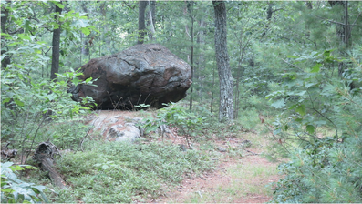
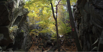
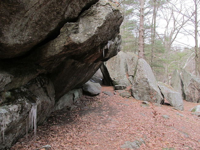
Eighteen thousand years ago, Worcester was smothered beneath 1,800 feet of ice. The blue-white wasteland extended in all directions, burying Mount Wachusett and slowly scouring away the soft sedimentary rock of more recent eons from ancient, underlying schists. Locked in an ice sheet that stretched from the Arctic to present-day New Jersey, Worcester County was unrecognizable: a crevassed expanse of silence reaching toward the rising sun and tumbling into Atlantic waters that were hundreds of feet lower than they are today. The Laurentide ice age was the culmination of one million years of glaciations that dramatically altered the New England landscape. Fluctuating temperatures during the Pleistocene resulted in glaciers repeatedly advancing and retreating across the region. The most recent major ice age – which, according to geologists, is still occurring – began 25,000 years Before Present (BP). Long winters and cool summers caused more snow to fall than melt. The snow eventually compacted under its own weight into an ice sheet that left a rugged legacy in Massachusetts. As the glaciers moved, they accumulated silt, gravel, and even boulders; water seeped into cracks in the bedrock, froze, and expanded, breaking off large chunks of stone that were carried away by the ice. When the ice began to melt around 17,500 BP, it deposited these sediments unevenly throughout the landscape. Leisurely hikes in Worcester County often reveal glacial features: Dexter Drumlin, Purgatory Chasm, eskers in Worcester’s Hadwen Park, erratics in Holbrook Forest, and innumerable wetlands, often the result of poor drainage in areas of tightly packed glacial till. Gradually the ice sheet receded from the region. By 14,000 BP, the barren earth was once again exposed to the sky. Another thousand years would pass before humans braved the tundra of Massachusetts. Archaeological evidence suggests that Paleo-Indians initially settled near major rivers and bodies of water. In 2015, an amateur archaeologist unearthed a small, triangular piece of flint in a Northampton potato field. He recognized it as a what it was right away – a Clovis point arrowhead. Researchers soon confirmed that the arrowhead was 12,800 years old, one of the oldest artifacts ever discovered in the state. Other archaeological sites in Western Massachusetts indicate that Paleo-Indians used the lush Connecticut River Valley as a seasonal hunting ground. Although similar prehistoric evidence is scarcer in Worcester County, fluted points have been found in the Chicopee and Blackstone River Drainages. Local Paleo-Indians likely lived in small, migratory bands, hunting mastodon as well as smaller game and fishing in the region’s many streams and ponds. They adapted to a warming climate that turned the tundra into a vast boreal forest, which, in turn, gave way to hardwoods. By 9,500 BP, ecological change and over-hunting had eradicated the megafauna and created a landscape that would shape humans’ lives for the next nine millennia. Worcester County became more densely populated during the Archaic Period (9,000-3,000 BP). Human settlement spread to present-day West Brookfield, Westborough, and other areas, where archaeologists have discovered projectile points, stone tools, and burial sites. Like their ancestors, Archaic peoples were predominantly hunter-gatherers. They travelled between seasonal hunting grounds in pursuit of game and were deeply familiar with the movements of birds and fish. They mined quartzite from local quarries to fashion weapons and tools, littering the ground with stone flakes that enable today’s archaeologists to identify sites of habitation (such as the Cracked Rock rockshelter in Millbury). Throughout this period, Archaic cultures evolved. The ancient residents of Worcester County adopted new styles of stone and bone craftsmanship as technology improved and fashions changed. They also came to depend more heavily on plant foods, giving rise to the development of local agriculture 3,000 years ago. This milestone was one of many that marked the transition from the Archaic era to the Woodland Period (3,000-450 BP). The millennia preceding European colonization would witness the genesis of contemporary Native American tribes and of the vibrant civilizations that greeted English settlers on the shores of the New World.
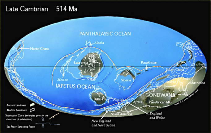
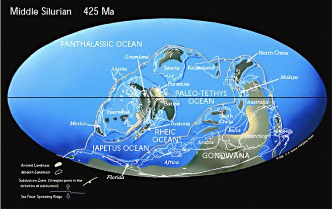
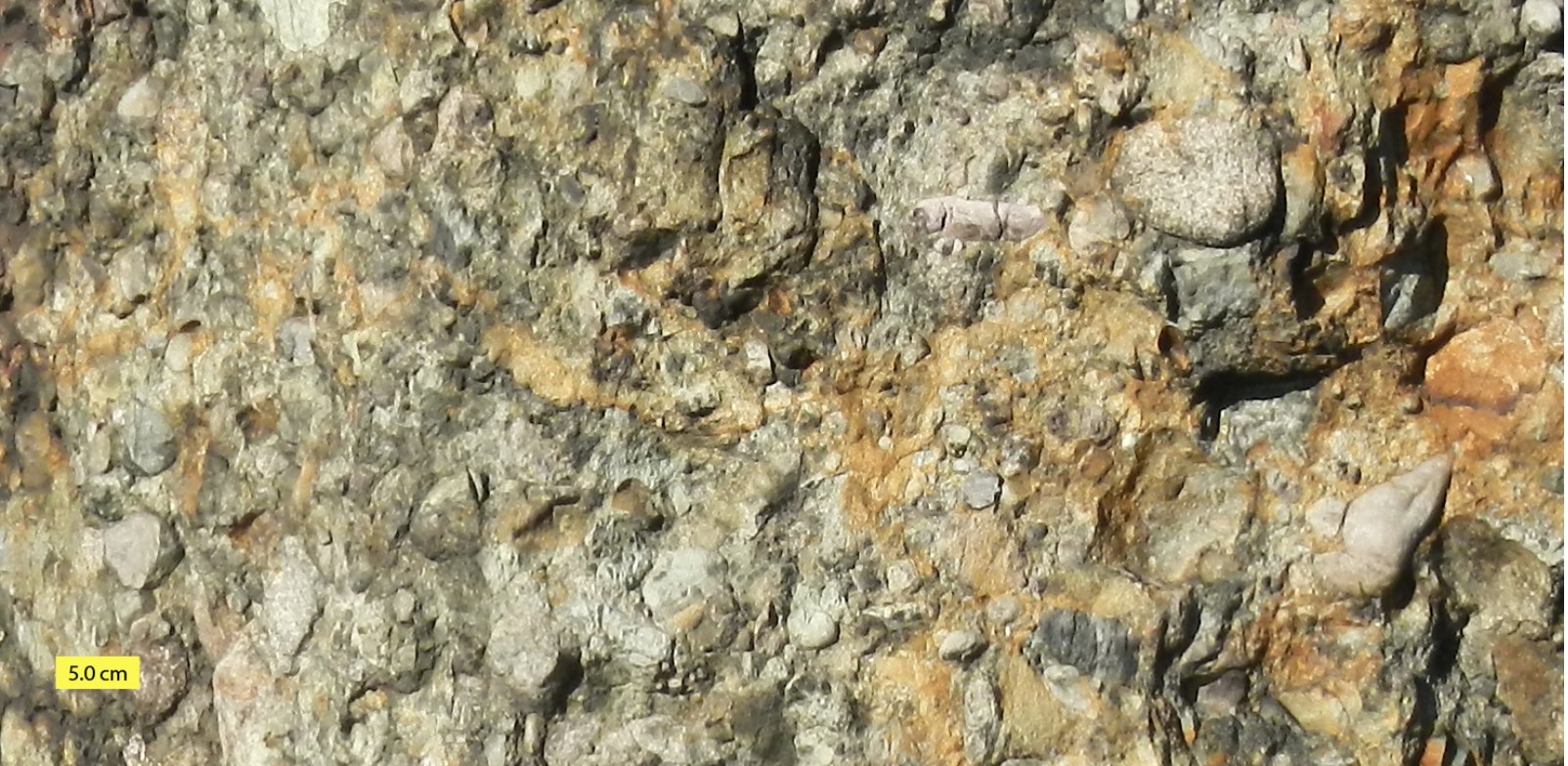
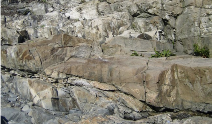
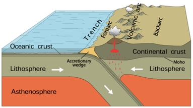 Subduction. Courtesy of USGS. Subduction. Courtesy of USGS. Imagine a world where South America is at the South Pole, Siberia, along the Tropic of Capricorn, and Greenland, at the Equator. In this world, Florida is a frigid strip of coast connecting South America and Africa. Canada bakes beneath a bright equatorial sun. The rest of North America is a scuba-diver's paradise – assuming scuba-divers numbered among the primitive, single-cell organisms that existed 550 million years ago. Welcome to the Late Precambrian, an era of dramatic geological change and the beginning of New England’s story. At this point, the earth was 3.5 billion years old. It had already experienced multiple episodes of continental drift, volcanism, and glaciation. The Grenville Mountain chain, formed during an earlier period of tectonic collision, had eroded. All that remained was a small layer of bedrock and a large amount of sediment that would eventually become western Massachusetts. Three major continents contained most of the planet’s land mass: Laurentia, Baltica, and the supercontinent Gondwana, whose coastline roiled with volcanic activity. The earthquakes and lava flows were symptoms of tectonic subduction (when one tectonic plate dives beneath another) and rifting (when two plates diverge). Over time, these subterranean stirrings formed the Avalon mountain range and Boston Rift Basin off the coast of present-day South America. We now call this region New England. As Earth entered the Cambrian Period, Avalon broke away from Gondwana. Sediments filled the rift basin and compressed into the Cambridge Argillite and Roxbury Conglomerate (puddingstone) rock formations underlying Greater Boston today. Between 430 and 390 million years ago, Avalon collided with Laurentia, forming the Northern Appalachians. This period of tectonic uplift coincided with rising oxygen levels and an explosion of multicellular life. Complex organisms spread across the globe as New England rose from the depths of the ocean. Over the succeeding eons, the planet’s crust continued to transform. The continents collided again 250 million years ago to form Pangaea, lifting the Appalachians to Himalayan heights, and then separated fifty million years later. This period of rifting created today’s continents and instigated more lava flows. We can still see evidence of this geological turbulence in the igneous and metamorphic rocks of Worcester County. Volcanic activity subsided as the continents drifted to their present locations. Massachusetts was thereafter shaped by deposition, weathering, and erosion. Temperatures rose, fell, and rose again, causing frequent glaciations that carved the Northeastern bedrock. Meanwhile, life evolved. The region was alternately submerged in shallow seas teeming with crustaceans and fish, and raised high and dry, a coastal forest where dinosaurs roamed. By the time Homo sapiens arrived in New England twelve thousand years ago, the region was a frozen tundra. The latest Ice Age scarred the landscape with eskers, dimpled it with kettle ponds, and pimpled it with erratics – a rugged topography that determined where humans settled, and upon which they would eventually unleash their transformative might.
|
AuthorArchitectural Heritage Foundation (AHF) is working to preserve and redevelop the Worcester Memorial Auditorium as a cutting-edge center for digital innovation. Archives
May 2022
Categories
All
|


 RSS Feed